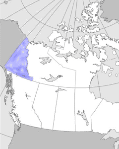
Yukon Territory
takes its name from the Loucheux Native name Yu-kun-ah for the
"great river" which drains most of its area. Lying in the northwestern
corner of Canada's continental mainland, isolated by rugged
mountains, it shares a common border and many characteristics
with its American neighbour, Alaska. Historically, it is indelibly
associated with the great Klondike gold rush.
The climate of the Yukon is
continental, with its mountain ramparts sealing it off from
most direct contact with the moderating Pacific Ocean. Winters
are very cold most of the time, with the lowest temperature
ever recorded in Canada (-62.8ºC) at Snag, northwest of Kluane
Lake, in February 1947. At times, Pacific air may edge into
the southwestern sectors resulting in short intervals of milder
temperatures. Summers are warm and frequently hot (35ºC has
been recorded at Dawson) but cooler air from the Arctic can
push southward. Precipitation is generally low because the high
mountains in the southwest seal off access to the moister air.